At 6am I leave the gate of Baldy village Ranger Station heading up Bear Creek trail. The lactic builds up in my quads immediately as the steep switchbacks waste no time leading up and away from town through the forested canyon. I catch the sun coming over Telegraph peak to the east at the top of the severe Bear Flat switchbacks. I divert off trail to the West Baldy having seen only one other person on the trail. After a breather I head for Baldy proper. It's one of those windy days where the air whips across the ridge line having risen from thousands of feet below. If you stay ten feet away from the edge you can escape the worst of it but I'm careful that a sudden gust doesn't steal my hat.


On the way down the scree fields lots of folks are making their way up and down. I avoid most of them hopping and sliding around on the rocks doing my best to maintain balance but also keep a fluid pace. With all the climbing in this route I know that the only time I can make up is in the descent. At the saddle with rim of the world trail I divert left up to Harwood peak with it's weather surveillance robot. On the way down to the notch I encounter a lot of runners. Many on the way up. Impressed by this increase in popularity of mountain running I refill my 2 liter pack at the water fountain and begin the climb to Thunder Peak. A jet ski is stranded on the slopes near the top of the chair lift, anchored to the rocks like a ship on dry land. Telegraph peak is one of my favorites. It's so rocky and sits so prominently that the views are unbeatable.


The fatigue of the first five peaks begins to set in as I continue toward the third T. I meet a guy who says I am doing great and that it encourages him. I also meet a girl who asks how far I've come. It's always nice getting to share that you are on a bit of an adventure. I find a water bottle on the way down to icehouse saddle (aargh). I grab the trash and begin the climb to Cucamonga. A little ways up the switchbacks past the big horn saddle I meet a woman asking how far it is to the summit. I try to encourage her but she is skeptical of my mileage estimation. It's not like Ive climbed this peak 10 times or anything! O well. Hope she made it.

After cucamonga I head further east towards a lesser known 8660' peak called Etiwanda. It's quite a descent to approach the peak and after a little trouble determining which one it is I climb a rocky false summit. O well extra miles! Then I get the real thing. I climb back over the Cucamonga ridge and drop back down to bighorn saddle. I get out my headphones for the off-trail climb to Big Horn peak. This is a frustrating, steep ridge that climbs almost 1000' in less than a mile to an anticlimactic peak(in my opinion) I dont spend long, wanting to get on to the final push.By this time Im running out of water. I know I can ration and make it to the peak, but I dont know if the springs in icehouse canyon are flowing which means I may have a long thirsty trek back to the village.


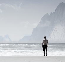
We train in difficult conditions to be emotionally prepared for the onslaught of difficulty. The world doesn't go the way you want it, so instead of trying to change it, which is our usual mode of operation, we must teach ourselves to be flexible and always smile. After summiting Ontario I do my best to roll down through icehouse and down highway 2. The springs are flowing but pretty low so I decide not to risk it. I arrive on the other side of the ranger station gate after 10hrs feeling humbled by these mountains but lucky to have enjoyed so much of them. The great part of this course is that you can see all ten peaks from most places on it.

10 PEAKS, 52k +12,000'
Gps of route:
www.strava.com/activities/667100352